GeoJsonLoader
Renders GeoJson file. This component is intended to easily use external GeoJson files. But it does not handle loading errors at all.
So you should rather use the GeoJson component in production.
Example
Code
import { Map, GeoJsonLoader } from "pigeon-maps";
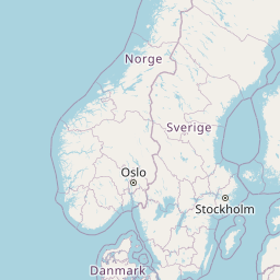
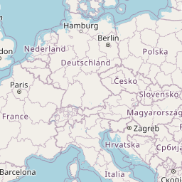
const geoJsonLink = "https://raw.githubusercontent.com/isellsoap/deutschlandGeoJSON/main/2_bundeslaender/4_niedrig.geo.json"
const MyMap = () => (
<Map height={300} defaultCenter={[50.879, 4.6997]} defaultZoom={4}>
<GeoJsonLoader
link={geoJsonLink}
styleCallback={(feature, hover) =>
hover
? { fill: '#93c0d099', strokeWidth: '2'}
: { fill: '#d4e6ec99', strokeWidth: '1'}
}
/>
</Map>
)
Options
link
A link to a geo json file
styleCallback
A callback function that is taking a a geojson feature and a boolean indicating if that feature is hovered.
It should return an object of svg attributes depending on the type of feature either for circle or path.
svgAttributes
An object of svg attributes depending on the type of feature either for circle or path.
className
An additional class name for the wrapper div.
style
Additional styling for the wrapper div.
Events
onClick
({ event: HTMLMouseEvent, anchor: Point, payload: any }) => void
onContextMenu
({ event: HTMLMouseEvent, anchor: Point, payload: any }) => void
onMouseOver
({ event: HTMLMouseEvent, anchor: Point, payload: any }) => void
onMouseOut
({ event: HTMLMouseEvent, anchor: Point, payload: any }) => void
Attribution
GeoJson File of Germany by isellsoap